State of Global Water Resources report informs on rivers, land water storage and glaciers
In order to evaluate the impacts of social, environmental and climate change on the Earth’s water resources, the World Meteorological Organization has released its inaugural State of Global Water Resources report.
In a time of rising demand and constrained supplies, the purpose of this annual stocktake is to support the monitoring and management of the world’s freshwater resources.
A summary of river flow, significant floods and droughts are provided in the report.
It sheds light on areas where freshwater storage could shift and emphasizes the critical function and susceptibility of the cryosphere (snow and ice).
The paper demonstrates how significant regions of the world had drier-than-average conditions in 2021, a year in which climate change and a La Nia event affected precipitation patterns.
In comparison to the 30-year hydrological average, the region with below-average streamflow was around two times greater than the region with above-average streamflow.
“The impacts of climate change are often felt through water – more intense and frequent droughts, more extreme flooding, more erratic seasonal rainfall and accelerated melting of glaciers – with cascading effects on economies, ecosystems and all aspects of our daily lives. And yet, there is insufficient understanding of changes in the distribution, quantity, and quality of freshwater resources,” said WMO Secretary-General Prof. Petteri Taalas.
“The State of Global Water Resources report aims to fill that knowledge gap and provide a concise overview of water availability in different parts of the world. This will inform climate adaptation and mitigation investments as well as the United Nations campaign to provide universal access in the next five years to early warnings of hazards such as floods and droughts,” said Prof. Taalas.
More than 5 billion people are anticipated to experience inadequate access to water by the year 2050, up from the current 3.6 billion.
According to UN-Water, 74% of all natural catastrophes between 2001 and 2018 have a water component.
The most recent UN climate change conference, COP27, urged governments to integrate water into adaptation efforts further.
This was the first time water was mentioned in a COP outcome document, recognizing its crucial importance.
The first edition of the report examines streamflow or the amount of water that is constantly flowing through a river channel.
Additionally, it evaluates the amount of water stored on land, including that in the cryosphere, the subsurface, and both (frozen water).
The data and associated maps are mostly based on remotely sensed data from NASA’s GRACE (Gravity Recovery and Climate Experiment) mission for terrestrial water storage and modeled data (to ensure the greatest geographic coverage).
Where available, the model findings were tested against observable data.
The paper addresses the paucity of available verified hydrological data.
The WMO’s Unified Data Policy aims to hasten the availability and exchange of hydrological data, such as information on transboundary river basins and river discharge.
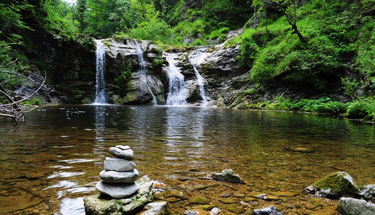
Streamflow
In comparison to the average of the 30-year hydrological base period, significant portions of the world experienced dryer-than-average weather in 2021.
The Rio de la Plata region of South America, where a protracted drought has plagued the area since 2019, the South and South-East Amazon, and basins along the Colorado, Missouri, and Mississippi rivers in North America were among these locations.
In 2021, the discharge from African rivers such as the Niger, Volta, Nile and Congo was below average.
In a similar vein, rivers in regions of West Siberia, Central Asia and Russia saw lower-than-average discharge in 2021.
Some basins in North America, the North Amazon, Southern Africa (Zambezi and Orange), China (the Amur river basin) and Northern India all had above-average river discharge.
A third of the studied locations were roughly in line with the 30-year average.
Numerous fatalities were reported from significant floods in countries including China (Henan province), northern India, western Europe and nations affected by tropical cyclones like Mozambique, the Philippines and Indonesia, among others.
A regional drought has been brought on by multiple years of below-average rainfall in Ethiopia, Kenya and Somalia.
Terrestrial water storage
Water that is stored on land or underground is referred to as terrestrial water storage.
On the West Coast of the United States, in the middle of South America and Patagonia, in North Africa and Madagascar, Central Asia and the Middle East, Pakistan and North India, and in comparison to the average calculated from 2002 to 2020, terrestrial water storage was categorized as below normal in 2021.
The Amazon basin, central Africa, northern South America, and northern China all had above-average temperatures.
The analysis identified a number of areas with a long-term downward trend in terrestrial water storage.
They include the Rio So Francisco basin in Brazil, Patagonia, the Ganges and Indus headwaters, and the southwest of the United States.
The Great Lakes region, the Niger basin, the East African Rift, and the North Amazon basin, on the other hand, show a positive anomaly.
In general, negative trends are more pronounced than positive ones.
A few of the hotspots are made worse by irrigation systems that take too much groundwater.
In several places, like Alaska, Patagonia and the Himalayas, the melting of snow and ice also has a substantial impact.
The Cryosphere
The largest natural freshwater reservoir on Earth is the cryosphere, which includes glaciers, snow cover, ice caps, and, when present, permafrost.
Because they are the source of rivers and freshwater supplies for an estimated 1.9 billion people, mountains are frequently referred to as natural “water towers.”
Food security, human health, ecosystem integrity and maintenance are all significantly impacted by changes to cryosphere water supplies, as are the development of the economy and society.
Hazards brought on by these changes include flash floods and river flooding from glacial lake eruptions.
When temperatures rise, the annual glacial run-off normally climbs initially before declining after reaching a tipping point, known as “peak water.”
The timing of peak water and the long-term estimates of the changes in glacial run-off are important factors in long-term adaptation decisions.
Future WMO assessments of the state of the world’s water resources will encourage regular evaluations of cryosphere changes and the variability of those resources at the basin and regional levels.
Source: The World Meteorological Organization
